Wisconsin Bicycle Routes |
|||
|
Bicycle Route Notes Racine/Kenosha Counties |
|||
|
Racine/Kenosha Counties East of I-94 For routes west of I-94, click here. Public transportation: The Kenosha and Racine public buses have bike racks. The Metra line between Chicago and Kenosha carries bikes on off-peak trains (see the Metra web site for more information). |
|||
|
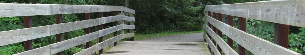
I. North-south routes A. Bike path route (see the description of the Milwaukee-Chicago route) 1. From Milwaukee County: WI 32 tends to be very busy, but recently was repaved. The shoulders get narrower between 7 Mile and 6 Mile roads (7 Mile Rd no longer crosses the railroad tracks). 2. Racine County Bike Path from 6 Mile Rd to Racine (compacted limestone). After entering Racine, there are directional signs from this path to both the Root River Pathway and the Lake Michigan Pathway. 3. Through Racine: the Root River Pathway offers a winding but scenic route through Racine using both streets and mostly paved bike trails. The pathway itself follows the Root River to the lake front (see next section), but a cutoff leads directly to the start of the Racine-Kenosha trail. The section through Colonial park is compacted limestone. It can be by-passed using Jefferson. 4. Racine-Kenosha Bike Path runs to the outskirts of Kenosha. It is freshly paved in Racine county and unpaved (sandy in spots) in Kenosha county. 5. Through Kenosha a. Bike street route. Includes some bike paths and two parks. Slow because of cross traffic. b. Direct street routes. None are particularly attractive. Suggest 30th Ave because it leads directly to path on south. 22nd Ave also an option. c. Pike Trail along lake (see below) 6. South of 89th St, a Kenosha county trail (compacted limestone) to Robert McClory Trail in Illinois, which runs to Chicago’s north shore suburbs B. Lake shore route (note that I have not found any of Sheridan Ave. attractive for bikes) 1. South of 6 Mile Rd to Racine. Roads through attractive rural and suburban country. Allows a side trip to the very attractive Wind Point lighthouse. PassesWingspread conference center by Frank Lloyd Wright. Pick up the Lake Michigan Pathway north upon entering Racine. 2. Through Racine. Lake Shore Pathway follows lake shore and then back streets to connect with Racine-Kenosha Trail. 3. Racine to Kenosha. Follow trail (see above). After crossing highway E follow the marked bike route to Carthage College at the lake shore. 4. Kenosha. The Pike Trail starts at Carthage College and runs south to downtown. It then follows a series of streets along the lake shore before moving inland to 7th. Seventh is a more direct route through downtown Kenosha, with some fine old houses. 5. South of Kenosha. Lakeshore Drive runs to 116th St. Normally a bicyclist would turn west on 116th and pick up either the bike trail or roads to Illinois. However, First Ct. goes south past the Chiwaukee Prairie before ending at the state line. A short (about 200 yds) dirt path leads to a marina with connections to bike trails in Illinois Beach State Park (sadly neglected) and Zion. Local riders seem to use this connection quite a bit–but it seems to have no official status. C. Inland route east of I-94 between Milwaukee county and Illinois. Between Milwaukee county and Franksville, Nicholson Rd and county H are alternative routes. From Franksville to Sturtevant, the route follows county H. From Sturtevant it follows 90th St and then county EA in Kenosha county. At 38th Street, it switches to county H which it follows to the state line. The countryside varies between rural, suburban, and some industrial parks. Probably more useful as connector and to fill in loop trips than an attraction in itself. II. East-west routes (listed from south to north). At some point most of these routes are forced to follow busy highways, but those chosen have reasonably good shoulders. A. State line route. Southwest from Kenosha on ML and then dip into Illinois. A connection to the start of the Des Plaines River Trail, a scenic unpaved trail that follows the river into Cook county. B. Prairie Springs Park. West on 85th, south on Cooper, and west on 93rd St and 95th St through park (lake is looped by bicycle trail). Then go west on the shoulder of Lakeview Parkway (heavy traffic but wide shoulder) past the intersection with I-94. Old Green Bay Rd serves to connect this route with the previous one. (A potential east-west route is Bain Station Rd but it dead ends at the very busy Green Bay Rd. C. Wilmot Rd. Take 60th St west from Kenosha. Particularly west of Green Bay Rd, it has moderately heavy traffic and poor shoulders. Take a series of subdivision streets to 104th St and follow that to county C (Wilmot Rd) with moderate traffic but good 3 foot shoulders. D. County N. From Kenosha, take 46th St to 55th Ave. Then follow 38th St (County S) west (traffic but good 3 foot shoulders). Continue on County N, which has much lower traffic. E. Kenosha County A. A paved trail starts at the intersection of county E and the Racine-Kenosha bike trail. It passes by UW Parkside and ends up at Petrifying Springs park (very scenic). Continue on the park roads to county A which goes west. F. Braun Rd. The Racine county bike route alternates between Braun and KR. Braun has less traffic but a somewhat poorer pavement. Taylor seems to be the best connector between Racine and Braun Rd–somewhat busy but with room for bicyclists and relatively low speeds. G. 16th Street. This route starts on 14th St in Racine and runs past Johnson Wax (famous Frank Lloyd Wright buildings), switches to 16th to West Blvd. Follow the bike path south for two blocks and then take the Racine-Sturtevant trail to Willow Rd in Sturtevant. Go north on Willow and then west on 16th. Use the route 20 shoulder to get under the railroad tracks (high traffic, wide shoulders). Follow winding Sorenson Rd. Short stretch on I94 frontage road. (Except for the din of constant traffic both the east and west frontage roads are bicycle-friendly from Milwaukee county line to state line. I saw one large group making use of the frontage road.) H. Spring Street to Old Spring. Passes Pike River Pathway which seemed very popular with local bicyclists. (West of Cty H quality of shoulders on Spring St deteriorates.) I. Northwestern Avenue. Fairly heavy traffic but good pavement and shoulders. Connects to Kraut with much lower traffic. J. Seven Mile Road. Generally low traffic through rolling farming country. Part of Racine County bike route and the Racine branch of the former Wisconsin Bikeway. III. Commuter routes in Racine and Kenosha. A number of possible routes are shown, but neither city is particularly bicycle commuter friendly. I found no marked bike lanes. The Racine Trails are much more oriented to recreational bicyclists than commuters, wandering about. Both cities restrict parking on most through streets either entirely or during rush hours, making them less bicycle commuter-friendly. A. Racine. The map shows a number of possible routes for commuters. Roads with heavy traffic shown are the more bicycle-friendly of the group. The relatively few bridges across the Root River tend to force bicyclists to use sections of busy streets. As mentioned earlier, a county bike trail goes west to Sturtevant from the south side of Racine, passing the Regency Mall. Here is a comment from a Racine bicyclist:
B. Kenosha is laid out on a grid, which in theory should be good for bicyclists. However, a relatively few streets are through and these tend to be quite busy. Most back routes are blocked by (largely defunct) industrial sites. I have tried to mark the most bicycle-friendly streets, but some commuters will probably choose others, since the differences are not great. On the west side, Pershing and Cooper are quite nice for riding. Racine/Kenosha Counties West of I-94 West of Interstate 94, Racine and Kenosha counties are largely rural with some patches of sprawl, particularly around Bristol. The terrain varies from largely flat farmland in the east to more rolling terrain around Burlington. In the western portion of Racine county, a number of roads have been designated as “Rustic Roads,” which make for attractive bike riding. There are also several lakes, concentrated near the Illinois border and north of Burlington. (In picking routes, I am a sucker for Rustic Roads and for roads along lake shores.) I. East-west routes A. State line route. This is a continuation of the route described in the earlier section and moves back and forth between Illinois and Wisconsin, mostly on back roads. The early part of the route passes through horse country. After passing through Antioch, IL (the end of a Metra line to Chicago–but no service on weekends), it turns north at the Fox River and Gander Mtn. to join the Wisconsin Bikeway at Wilmot. (At one time, Wilmot Mountain–a ski area–allowed mountain biking in summer, but that practice has been discontinued.) B. South Kenosha county route. This route takes back roads from Pleasant Prairie to Trevor where it joins the Wisconsin Bikeway. C. Wisconsin Bikeway (so-called, because it mostly follows the route of the former Wisconsin Bikeway). This route follows county C from I-94 to near Twin Lakes, passing through Trevor (historic one-room school house) and Wilmot (quaint cafe). It then passes through the community of Twin Lakes before heading southwest towards Genoa City. At Twin Lakes, it is also possible to precede north west towards Lake Geneva. The portion of the route east of Trevor is smooth with three-foot shoulders and moderate and fast traffic. Some bicyclists, therefore, may prefer one of the lower-traffic routes listed above although they are less direct. Past Trevor, traffic lessons and the route passes through several attractive small towns. D. Silver Lake route. This route branches north from the Wisconsin Bikeway at Liberty Corners, passing by Camp Lake and Silver Lake. It then passes Powers Lake to enter Walworth county and Lake Geneva. E. Mid Kenosha County. As with the Karcher Rd route (below), this route starts with County N (38th) St. (Initially it followed county K (60th St) to the Fox River. Mid-week, there was little traffic, especially because K does not intersect with the interstate or pass through any towns; however, a recent Saturday bike ride found quite heavy traffic east of Paddock Lake, including a surprising number of motorcycles, with no shoulders on most of this stretch.) At highway 45 (shoulders, moderate traffic), go south to NN (45th St). Follow NN until it merges into county K. K ends at the Fox River and the bicyclist can go along the Fox River route (see next section) either north or south to pick up one of the other routes. (Although not shown on the map, it is possible for the bicyclist to continue in the same direction by using the shoulders on highway 50. Highway 50 between Kenosha and Lake Geneva is a divided route with heavy traffic (for example Google recommends it as the route from Chicago to Lake Geneva). However, it has 8-foot shoulders. The route would then use the shoulder for about a mile, before following the parallel Geneva St. to Slades Corners. The shoulder would then be used for another mile before dropping to the south in Walworth county.) F. Karcher Rd. A low traffic route that had several groups of cyclists when I visited it. This route starts with County N (described above). It jogs north one-half mile on US 45 (moderate traffic in this section) and then continues on Karcher to its end, just before the Walworth county line. Offers access to the Bong Recreation area and Burlington. To continue into Walworth County, either go north on Fish Hatchery Rd. to South Lake Shore Dr or, at the end of Karcher, go north on Fishman. Both routes connect to County P (McHenry Rd). Go south on P (traffic, use shoulder) to Warren Rd. G. North Kenosha county route. Continues on county A (see earlier section) until it swings south to end at route 142. 142 has been reconstructed during the summer of 2005 and has decent shoulders and moderate traffic. Follow 142 through the Bong Recreation Area (mountain bike trails), before turning north on 288th Ave. (a Rustic Road) and follow Mt. Tom Rd. until it rejoins 142 shortly before Burlington. At Bushnell Park, the route picks up a bicycle trail that crosses the Fox River into Burlington. G. North Kenosha county route. Continues on county A (see earlier section) until it swings south to end at route 142. 142 has been reconstructed during the summer of 2005 and has decent shoulders and moderate traffic. Follow 142 through the Bong Recreation Area (mountain bike trails), before turning north on 288th Ave. (a Rustic Road) and follow Mt. Tom Rd. until it rejoins 142 shortly before Burlington. At Bushnell Park, the route picks up a bicycle trail that crosses the Fox River into Burlington. H. Kansasville-Burlington trail. This new unpaved trail runs between VandenBloom Rd just west of Kansasville to Bushnell Park in Burlington following an abandoned railroad right of way. It is accessible from either the North Kenosha route, above or the south branch of the Racine County Bike Route, described below. I. Racine County Bike Route, south branch. This follows the official Racine county route to Burlington, except that it crosses I-94 on Braun Rd. rather than KR (lower traffic since there is no interchange). J. Mid-Racine county route. This route goes to Waterford and Rochester and then continues west into Walworth County. K. Northern Racine county route. Follows 7 Mile Rd. to Wind Lake. Then follows various roads past Lake Tichigan west to county L and into Walworth County. II. North-South routes A. West of interstate route. Follows various back roads between Illinois and Milwaukee county. Despite its proximity to I-94, this route goes mostly through farming country and has little traffic. B. Mid-county north-south. Runs north from north of Paddock Lake. One branch goes to Wind Lake, the other to the south west corner of Milwaukee County. C. Silver Lake Route. Runs from the Illinois border north to Rochester. Then follows Marsh Rd into Waukesha county and, eventually, Waukesha. D. Fox River route. Runs from Illinois south of Wilmot to Burlington following the Fox River. Portion before Burlington is a rustic road. E. Western county route. Runs from Illinois through Twin Lakes to Burlington. F. Seven Waters Trail. A rail-trail roughly parallel to highway 36 from Burlington into Waukesha County. Most surface is crushed limestone but through Rochester and Waterford itis paved. Also connects to bike trails in Burlington. The trail continues next to highway 36 to the Milwaukee county line at Highways OO and 45, forming part of the Milwaukee-Elkhorn route. G. Roads north of Burlington. There are a number of quite scenic roads in the Burlington area, several of which are designated as Rustic Roads. These roads can be used to go from Burlington to Rochester. From Rochester, one route leads northeast through Waterford to Wind Lake and towards Milwaukee; another goes straight north towards Waukesha. From Burlington, routes lead northwest through Walworth county towards Mukwanago. They can be combined with the Seven Waters Trail for scenic loop trips. III. Burlington Bike Trails. Burlington has recently constructed several paved bike trails. One runs from the end of the Seven Waters Trail along the west bank of the Fox River before crossing the river and passing through Bushnell Park to connect with the Kansasville-Burlington trail.
|
|||