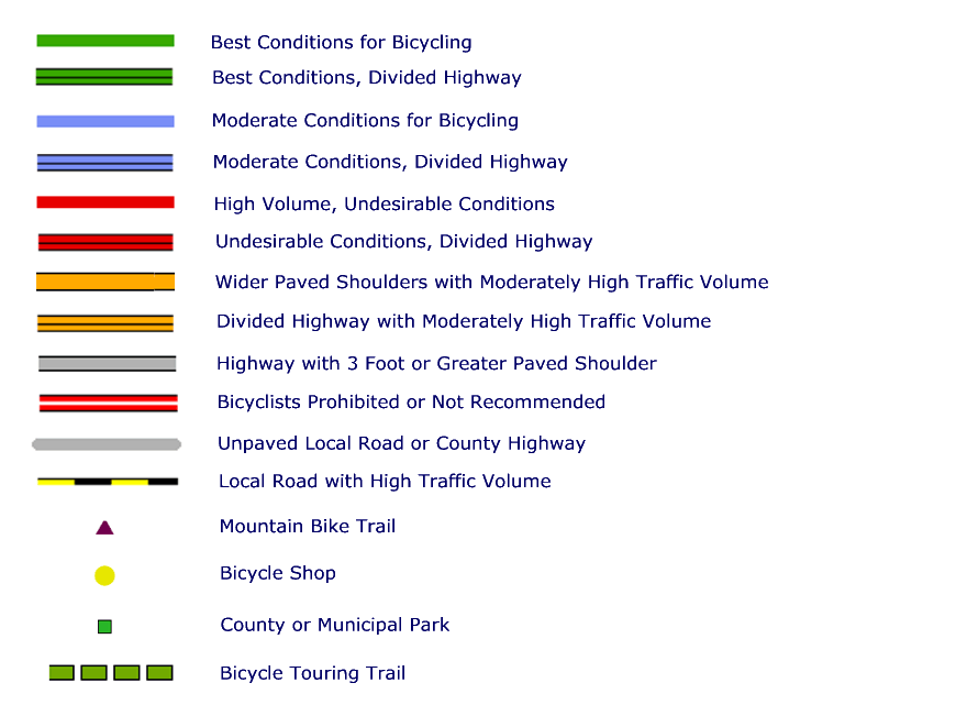
The Wisconsin Department of Transportation publishes bicycle maps of each county. These maps rate state and county highways for their suitability for bicycling as shown on the legend to the right. Note that the most desirable routes are colored green, the least desirable are shown in red, with blue for those in the middle.
As with the very similar state bike map, these maps only hint at continuous bike routes connecting one part of the state with another. The maps listed below are based on these county maps but yellow overlays added suggesting possible bike routes. These routes shown were taken from a number of sources, but particularly the out-of-print maps and guides. Unfortunately, in copying these maps some of the detail in the originals was lost.
|
Note that in a number of cases, these routes use sections of roads marked in red by the Wisconsin DOT. Particular caution should be exercised in using these routes. Around towns these roads may be particularly busy during the week during morning or evening rush hours. In other cases, particularly in vacation areas such as Door County, the worst traffic may be on the weekends. |
 |
|||||||||||||||||
| Adams Ashland Barron Bayfield Brown Buffalo Burnett Calumet Chippewa Clark Columbia Crawford |
Dane |
Iowa Iron Jackson Jefferson Juneau Kenosha Kewaunee La Crosse Lafayette Langlade Lincoln Manitowoc |
Marathon Marinette |
Polk Portage Price Racine Richland Rock Rusk Sauk Sawyer Shawano Sheboygan St. Croix |
Taylor Trempealeau Vernon Vilas Walworth Washburn Washington Waukesha Waupaca Waushara Winnebago Wood |
|||||||||||||

|
||||||||||||||||||